Facilitates urban planning by enabling the acquisition, management, and analysis of geospatial data from aerial surveys and Mobile Mapping Systems (MMS). This supports activities related to the management of urban areas.
Enviroment and territory
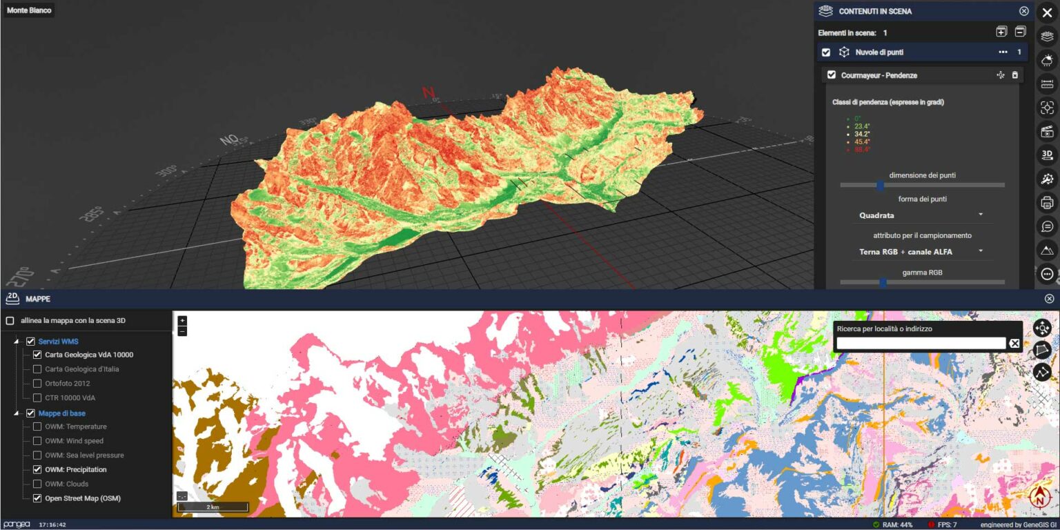
Facilitates the management of protected areas, forest monitoring, natural and archaeological parks, watersheds, marine ecosystems, agricultural zones, and other natural environments. Streamlines ecosystem monitoring activities, environmental impact assessments, enhances environmental risk management and mitigation efforts, and supports the planning of sustainable resource management policies.
Water and energy operation
Management of artificial reservoirs, hydroelectric power plants, water treatment facilities, irrigation systems, and other infrastructure related to the supply and management of water resources. Additionally, it supports the design, monitoring, and maintenance of power generation plants and energy distribution networks, including those related to hydroelectric, solar, wind, and biomass energy.
Civil and enviromental Infrastructure
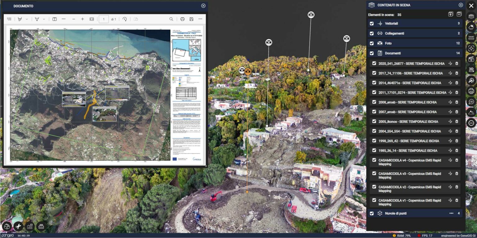
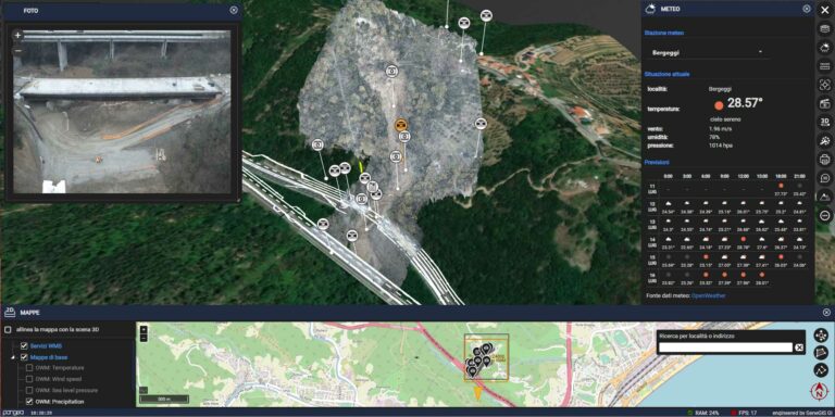
Management of major civil engineering projects such as skyscrapers, residential and commercial buildings, stadiums, hospitals, and industrial facilities. Environmental infrastructure includes monitoring of glacial and periglacial areas, rockslides, including mining extraction, remediation of contaminated sites, and waste storage facilities. It supports monitoring plans, intervention simulation, and analysis of anthropogenic and environmental interferences.
Transportation infrastructure
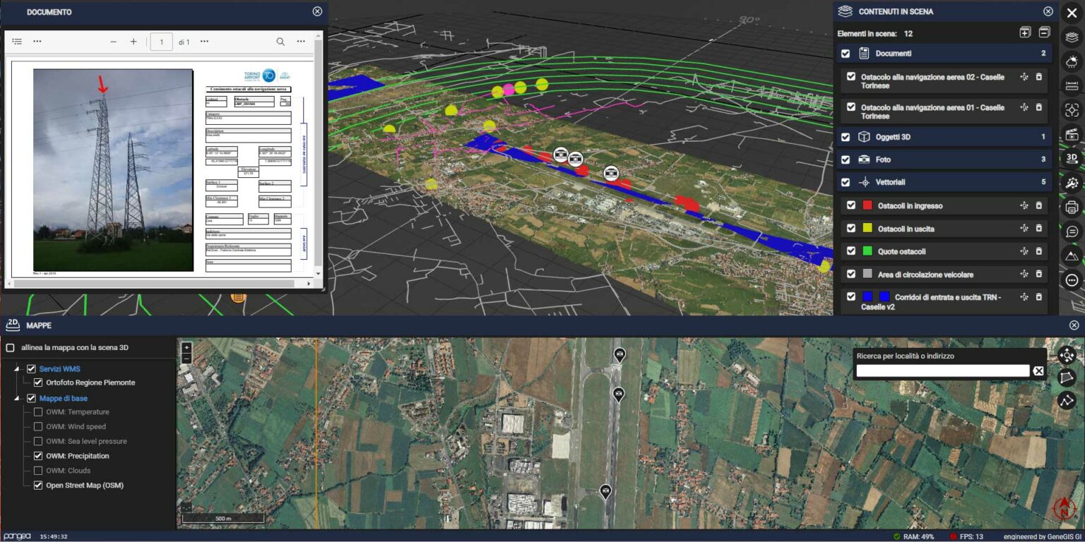
The management of major infrastructure projects encompasses highways, roads, bridges, tunnels, cable systems, airports, ports, and rail transportation systems, including high-speed trains and subways. This management facilitates stakeholders in monitoring and analyzing performance, planning maintenance, assessing the impact of modifications and upgrades, and enhancing the design, construction, and operation of new infrastructures.
DO YOU REQUIRE ADDITIONAL SERVICES?
Data detection
We create the digital extension of your asset using the best availabletechnologiestailored to yourobjectives. Thereis no perfect tool, butrather a variety of technologies, each with itsownstrengthsand weaknesses. Integratingthemallowsus to achieve the best results.
Processing
We analyze, process, and transform your raw data into high-value digital databases. The greater the availability of standardized data, the wider the range of reuseopportunities, leading to sustainableoperationalautonomy
Geographical intelligence
We integrate and processexternal public and private sources to support the intervention plans of your project. The effectiveness of a process can be measured by itsability to strike a balance between the variousinterestsat play.