In an era where wildfires pose a growing threat to the environment and community safety, the effective management of geospatial data is crucial for investigative and preventative measures. In this context, the Forest Fire Information Unit (NIAB) of the Carabinieri relies on Pangea Cloud, a cornerstone in managing diverse geospatial data formats, to support their investigative efforts.

NIAB and the Battle Against Wildfires
 
NIAB stands as a highly specialized division within the Carabinieri, dedicated to the prevention, control, and investigation of wildfires. Their role is pivotal, given that wildfires pose a constant threat to biodiversity, natural resources, and public safety.
 
In the event of wildfires, the effectiveness of investigations and investigative activities becomes paramount in determining causes and responsibilities, as well as in developing strategies to prevent future disasters. In this context, the collection, analysis, and management of geospatial data play a central role in ensuring the success of NIAB’s operations.
 
A Strategic Partnership for Effective Response
 
The collaboration between NIAB and Pangea Cloud has provided NIAB with access to a host of key advantages in geospatial data management:
 
Data Integration: Pangea Cloud enables the seamless integration of geospatial data from diverse sources, including satellite surveys, GPS data, meteorological maps, and more. This integration empowers NIAB to gain a comprehensive and precise understanding of the situation.
 
Advanced Analysis: Leveraging Pangea Cloud’s robust analysis capabilities, NIAB can perform sophisticated analysis of geospatial data. This encompasses identifying high-risk areas, mapping fire-affected zones, and assessing damage extent.
 
Collaborative Management: Pangea Cloud facilitates real-time collaboration among different teams and agencies involved in fire management. This streamlines the exchange of critical information and coordination of investigative efforts.
The Impact of Collaboration
 

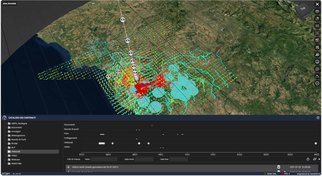
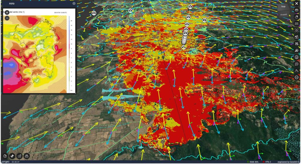
The partnership between NIAB and Pangea Cloud has already shown its positive impact. Through advanced geospatial data management, NIAB conducts more precise and responsive investigations into wildfires. This not only helps determine fire causes but also enhances prevention strategies and emergency responses.

This collaboration highlights how technological innovation, applied to critical situations like wildfires, can yield significant results. Geospatial data management plays a vital role in environmental protection and public safety, and NIAB and Pangea Cloud remain committed to working together to ensure effective and efficient mission execution.

I dati resi disponibili dalla piattaforma Pangea Cloud sono:

• Rilievi Laser Scanner Ambientali e Architettonici dell’area soggetta a ripristino
• Immagini satellitari
• Fotogrammetria aerea
• Documenti e schede tecniche
• Foto 360°

• Video da riprese a terra e da drone
• Dati meteo
• Dati video rilevati da cam in streaming
• Dati interferometrici GBInSAR e InSAR da satellite e loro disamina in tempo reale in confronto all’ andamento della temperatura nell’ambiente circostante,
• ecc.