Iren is one of the most significant and dynamic multi-utilities in the Italian landscape, operating in the sectors of electricity, gas, thermal energy for district heating, integrated water services management, environmental services, and technological services. The Group operates across multiple regions with over 8,000 employees, serving a portfolio of approximately 1.9 million customers in the energy sector, around 2.8 million residents served in the integrated water cycle, and over 3 million residents in the environmental cycle (data from 2019).
Project Description
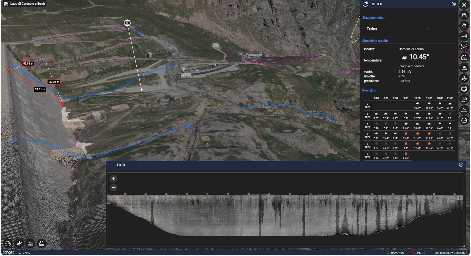
In 2019, Iren launched an aerial remote sensing project of its dams, carried out by our partner DigiSky using the Skymetry service. The extensive amount of remotely sensed digital data highlighted the need for a platform that would enable quick and intuitive access. Thanks to the collaboration between GeneGIS GI and DigiSky, the project was integrated and enhanced with the Pangea Cloud platform. The aim was to provide Iren’s Hydropower Sector with an end-to-end system capable of supporting monitoring and maintenance operations in challenging high-altitude environmental conditions.
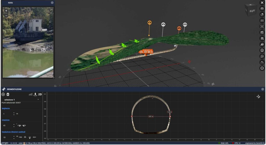
The service entails high-resolution stereoscopic photogrammetric surveying of the dam and the entire reservoir basin, achieved by coordinated flight planning of aircraft and APR drones. The Pangea Cloud platform enables the integration of all collected data (aerial, drone, and satellite) concerning the targeted reservoirs, with the available information on the structure (documentation, photos, and video inspections), providing an operational tool for managing and preliminary designing activities of both ordinary and extraordinary interventions.
The data distributed by the system include, among others: digital cartography via OGC services, 3D Point Clouds, Orthophoto maps and plans of dam fronts, 2D/3D CAD/GIS elaborations, Video inspections, Traditional and drone-based aerial reconnaissance, Video surveillance systems, Webcams, Meteorological data, Geo-referenced technical documentation, etc.
The activities and goals of the Iren-Hydroelectric Project:
Periodic aerial surveys of reservoirs and related structures.
Execution of on-demand flights for specific intervention.
Delivery of 2D/3D photogrammetric products.
Analysis of databases from new airborne sensor data.
Analysis of historical database.
Collection of operational monitoring needs.
Implementation of a system for collecting, harmonizing, visualizing, querying, and sharing existing information assets.
The data provided by the Pangea Cloud platformincludes:
Environmental and Architectural Laser Scanner Surveys of the restoration area
Satellite imagery
Aerial photogrammetry
Documents and technical specifications
360° photos
Ground and drone-captured videos
Weather data
Video data captured by streaming cameras
GBInSAR and InSAR interferometric data from satellites, with real-time analysis compared to temperature trends in the surrounding environment, and much more.