ANAS (Azienda Nazionale Autonoma delle Strade) is an Italian company playing a pivotal role in managing, maintaining, and expanding the country’s road network. Established in 1946, it oversees the construction, upkeep, and safety of Italy’s highways and national roads. The company is committed to ensuring a secure and efficient road infrastructure, thereby enhancing mobility and connectivity throughout Italy. ANAS is instrumental in both routine and extraordinary road maintenance, spearheading technological innovation, constructing new infrastructure, and implementing road safety measures. Moreover, ANAS is actively engaged in infrastructure monitoring and maintenance efforts, as well as the sustainable development of Italy’s road networks. 

Project Description: 

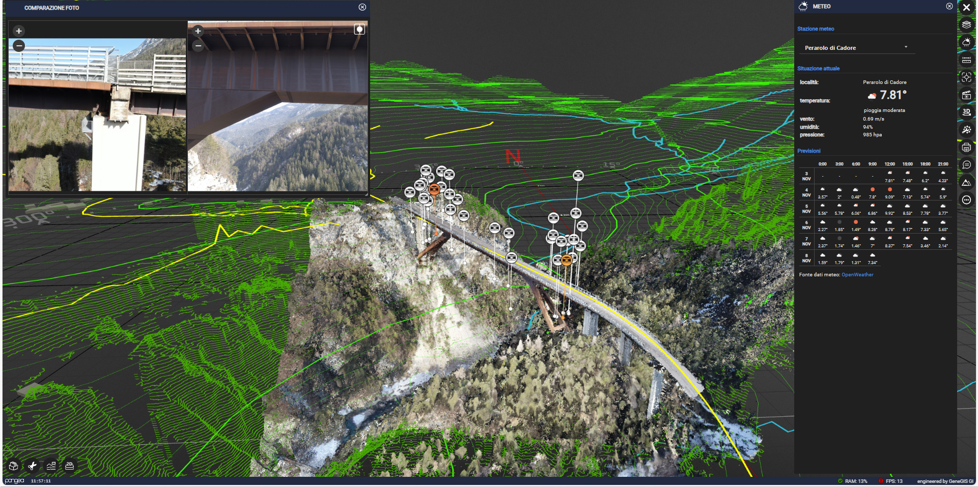
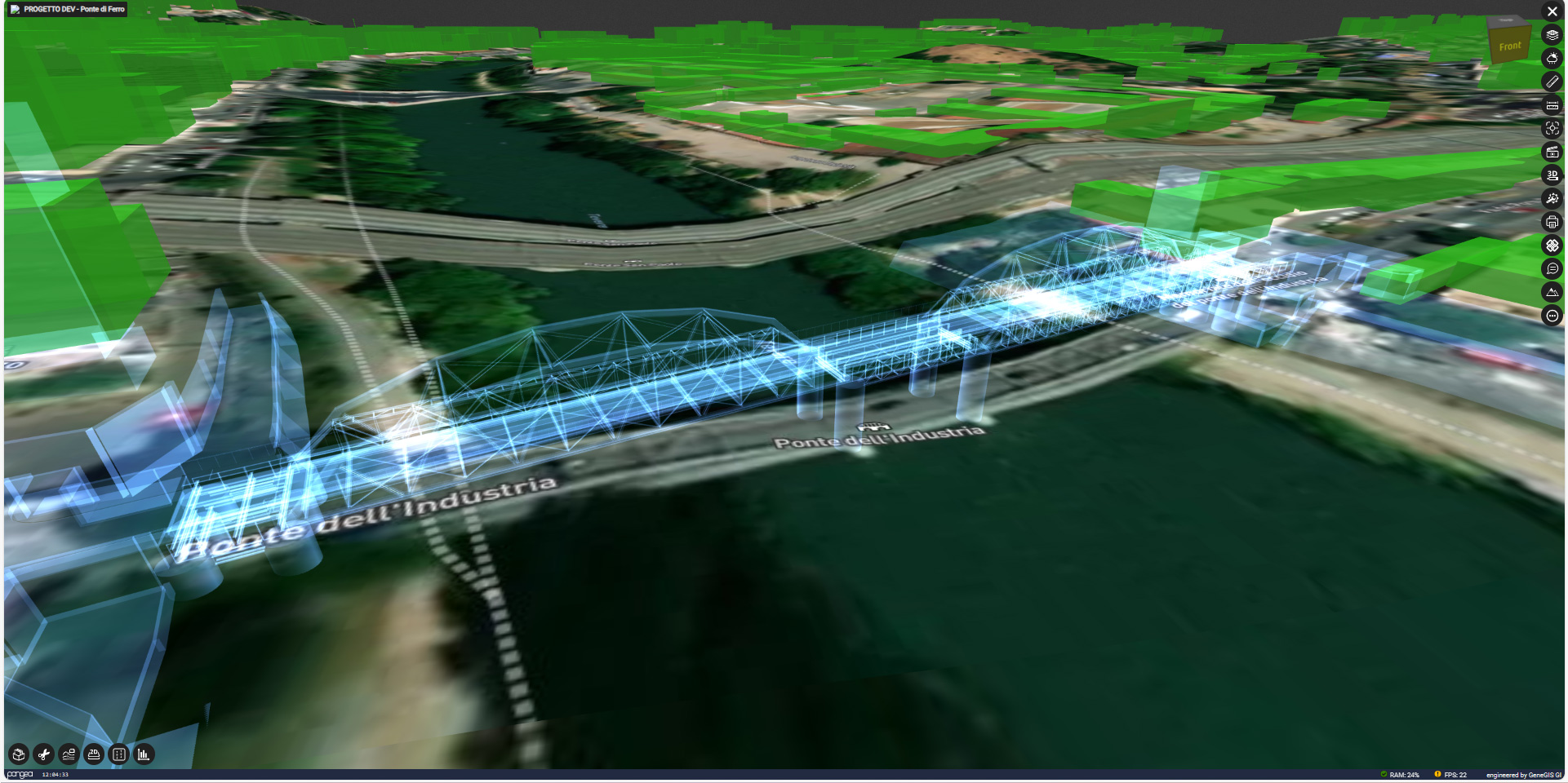
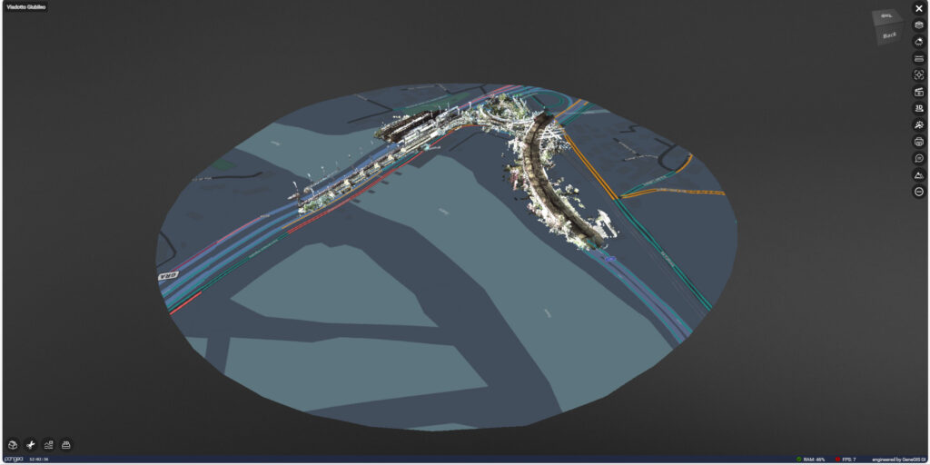
In the first quarter of 2023, GeneGSI, in collaboration with e-GEOS, as part of the research and development initiatives promoted by ANAS to enhance the efficiency of road infrastructures, is engaged in a pilot project aimed at improving the management of data collected during AS-IS monitoring activities using MMS and LiDAR techniques from Drones, with a specific focus on viaducts, leveraging Pangea Cloud. 

Within the project scope, the performance, limitations, and peculiarities of the instrumentation utilized in reality capture are examined. These are integrated with existing historical assets (preliminary and executive projects) to support GeoBIM modeling. Concurrently, the cloud performance of the latest available libraries supporting the analysis activities of anomalies identified in the field by ANAS technicians is evaluated. 

In this context, Pangea plays a pivotal role in the multi-asset management of the viaducts in question. Each viaduct is equipped with a digital dossier accessible via the cloud, streamlining the review of current conditions, monitoring and inspection plans, which include 3D point clouds, GeoBIM models, photos, and video inspections. The immersive scenes provided by the Digital Twin actively facilitate the identification and analysis of issues, with the added capability of utilizing VR headsets. 

The project is presently underway. 

The data provided by the Pangea Cloud platform includes: 

  • Environmental and Architectural Laser Scanner Surveys of the restoration area 
  • Satellite imagery 
  • Aerial photogrammetry 
  • Documents and technical specifications 
  • 360° photos 
  • Ground and drone-captured videos 
  • Weather data 
  • Video data captured by streaming cameras 
  • GBInSAR and InSAR interferometric data from satellites, with real-time analysis compared to temperature trends in the surrounding environment, and much more.